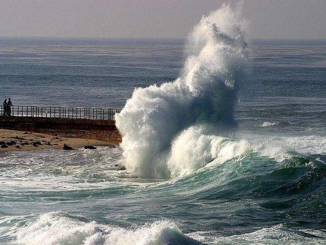
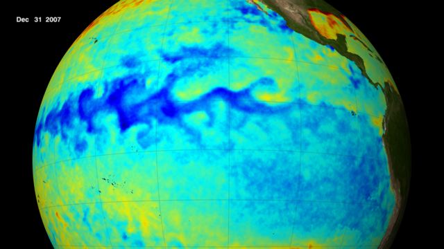
 Blue area at center of Pacific Ocean shows cool sea surface temperatures along the equator during the 2007 La Niña. Credit: NASA/Goddard’s Scientific Visualization Studio.
The powerful Pacific Ocean climate pattern known as La Niña returned in August, after briefly dipping into neutral territory last May.
Yesterday’s La Niña advisory from the Climate Prediction Center forecasts that the newborn La Niña—currently weak—will strengthen later this autumn and winter.
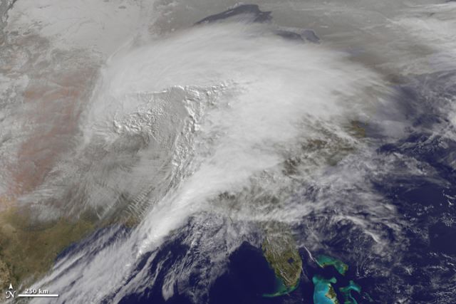 Historic winter storm of 1-2 February 2011 moving across eastern US. Credit: NASA Earth Observatory.
A return to La Niña raises the possibility of more of the wild weather of last winter and spring—extreme blizzards, extreme tornadoes, extreme cold, extreme heat, extreme drought, extreme rainfall—around the globe.
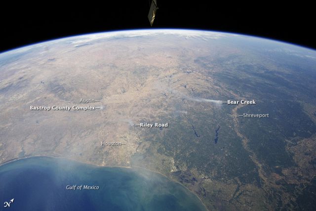 Panoramic view from the International Space Station of East-Central Texas on September 6, with numerous wildfire smoke plumes. Credit: NASA Earth Observatory.
Jeff Masters at his Wunderblog reminds us of some specifics:
Drought conditions are common over the southern tier of states during a La Niña event, since the cooling of the equatorial Pacific waters usually pushes the jet stream such that rain-bearing low pressure systems pass through the Midwest and avoid the South. It is likely that the drought gripping Texas, Oklahoma, and New Mexico will continue well into 2012, due to the emergence of La Niña. La Niña events also typically cause wetter than normal winters in the Pacific Northwest and Ohio Valley, colder winters in the Pacific Northwest and northern Plains, and warmer temperatures in the southern states.
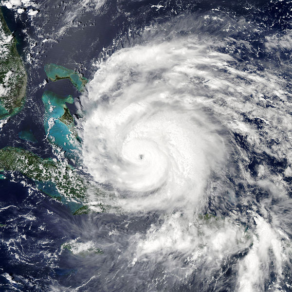 Hurricane Irene. Credit: NASA Earth Observatory.La Niña is also one of the variables contributing to this year’s extremely active hurricane season, with 14 named storms formed before the halfway mark. An average year sees 10 to 11 named storms in the entirety of the season.
Elsewhere in the world, the last La Niña contributed to:
-
Floods in Australia (one of that nation’s worst natural disasters)
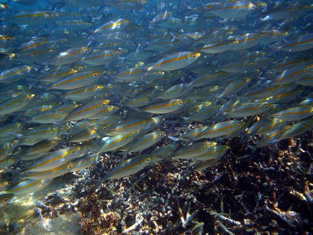 Credit: Mila Zinkova via Wikimedia Commons.
It’s also good to remember that a rejuvenated La Niña provides real bennies to some locales.
Invigorated Pacific trade winds drive upwelling along the coast of South America, sending ocean productivity into overdrive and providing excellent conditions for plankton, fish, seabirds, and marine mammals—many of which will experience population booms.
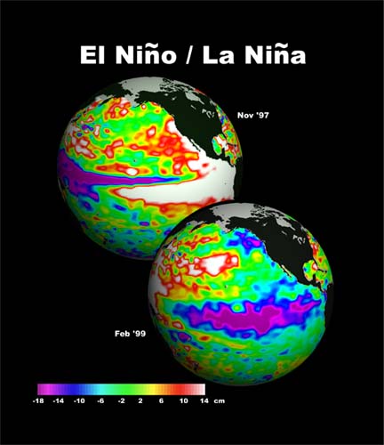 El Niño conditions on top globe, La Niña conditions on bottom. Credit: NOAA.
Technically, La Niña is one-third of the ENSO triad known as the El Niño/La Niña-Southern Oscillation. The El Niño/La Niña phases are characterized by variations in the sea-surface temperatures of the tropical eastern Pacific:
-
El Niño with warmer waters
-
La Niña with cooler waters
-
Neutral with neutral waters
The power of this oscillation is staggering—rearranging trade winds, rearranging ocean depths, rearranging ocean temperatures, and rearranging ocean productivity. The three diagrams below describe how that works.
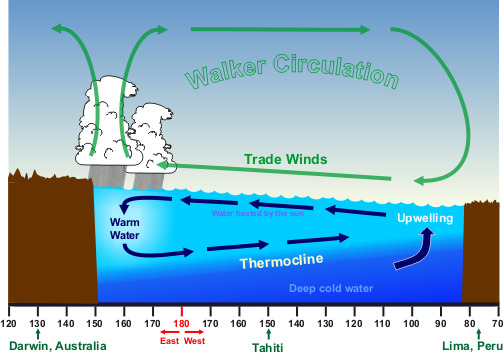 Neutral ENSO conditions. Credit: NOAA.
Neutral conditions (above): Sea surface temperatures are higher in the Western Pacific than off South America. Trade winds blowing east to west along the equator allow the upwelling of cold nutrient-rich water from deep waters off the coast of South America. Trade winds push the ocean west, piling water up in the western Pacific, with average sea-level heights running about 1.5 feet/0.5 meters higher off Indonesia than off Peru. A deep 450 feet/150 meter warm layer, known as a thermocline, forms in the west, while the thermocline in the east rises to 90 feet/30 meters. The shallow eastern thermocline allows the winds to pull up cooler nutrient-rich from below.
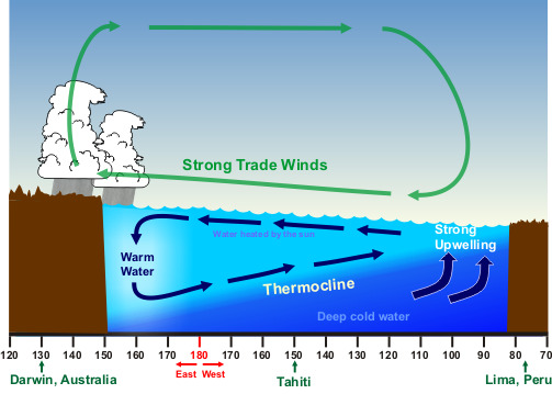 La Niña conditions. Credit: NOAA.
La Niña conditions (above): Trade winds blowing west across the tropical Pacific are stronger than normal, leading to an even shallower thermocline in the east off South America, along with increased upwelling and lower than normal sea surface temperatures. Prevailing rain patterns shift farther west than normal. Winds pile up warm surface water in the western Pacific.
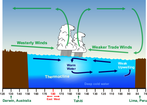 El Niño conditions. Credit: NOAA.
El Niño conditions (above): Air pressure at Darwin, Australia (Western South Pacific), is higher than at Tahiti (Central South Pacific). Trade winds decrease in strength and may reverse direction causing the normal flow of water away from South America to diminish and causing ocean water to pile up off South America, pushing the thermocline deeper, as upwelling dwindles. The flip in the thermocline and the decreased westward flow of water allow sea surface temperatures to rise higher than normal in the Eastern Tropical Pacific. The net result is a shift of the prevailing rain pattern, with the Central Pacific getting wetter as the Western Pacific gets drier.
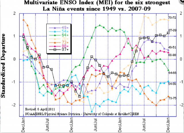 Comparison of the six strongest La Niña events since 1950. Credit: Klaus Wolter, NOAA.
It’s uncommon for one La Niña to follow on the heels of a prior La Niña—though it’s less uncommon when the onset of the first La Niña is fast and really cold… which is how it went down last winter.
Klaus Wolter, research scientist at the Climate Diagnostics Center at the University of Colorado, recreated conditions back to 1870 and found 10 cases in which La Niña lasted at least two consecutive years. He also found signs of persistent drought in the US Southwest in 8 of 10 of the double-dip La Niñas.
