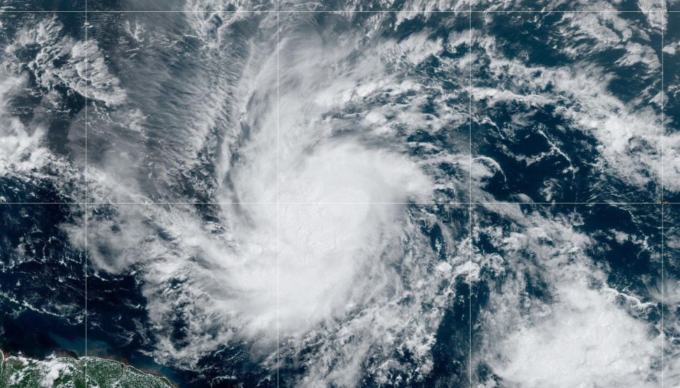
A depression in the central Atlantic has strengthened into Tropical Storm Beryl. NOAA/ZUMA
The Caribbean is bracing for an epic storm, as residents of Barbados and other southeastern islands have rushed to prepare for its onslaught early this week. By the time the storm makes landfall Sunday night or Monday morning, the winds are likely to reach up to 113 mph. Ralph Gonsalves, the prime minister of St. Vincent and the Grenadines warned, “Please take this very seriously and prepare yourselves. This is a terrible hurricane.”
Experts have pointed to the highly unusual nature of a storm of this intensity developing so relatively early in the hurricane season. The Associated Press spoke to Michael Lowry, a hurricane expert, who said, “Beryl is an extremely dangerous and rare hurricane for this time of year in this area. Unusual is an understatement. Beryl is already a historic hurricane and it hasn’t struck yet.”
Lowry noted that the only comparable storm was Hurricane Dennis in early July 2005, which tore through the Southeastern United States as well as the Windward Islands and caused an estimated $3.98 billion in damages. But with ocean temperatures at record highs, hurricane season is already predicted to be especially brutal this year. Those high temperatures accelerated the speed with which Beryl progressed from a tropical depression to a hurricane initially with 75 mph winds.
As Inside Climate News reported earlier this year:
NOAA expects above-normal hurricane activity this season, with 17 to 25 named storms including eight to 13 hurricanes and four to seven major hurricanes of category 3, 4 or 5 strength, packing winds of 111 miles an hour or more. The federal agency based its unprecedented forecast on a confluence of factors, most notably near-record sea surface temperatures that are as warm now as they normally are in August.
“That forecast is the greatest number of storms that we’ve forecast,” said Ken Graham, director of the National Weather Service. “Now is the time to prepare.”
This is a developing story.


