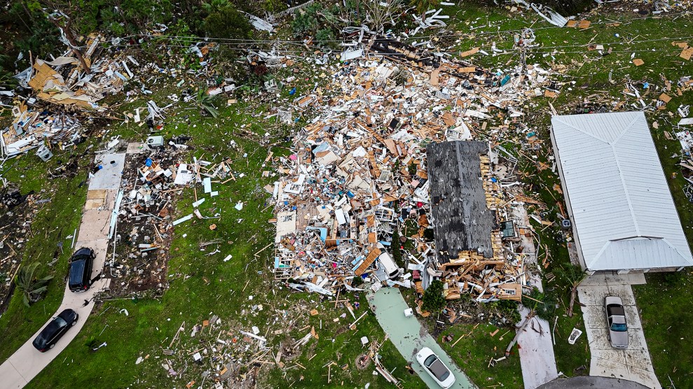
When my editors assigned me to fact check Kate Sheppard’s feature “Under Water,” part of my task was to come up with accompanying visuals that would illustrate how sea level rise could destroy coastal cities as we know them. Initially, I set out looking for flood maps of the entire Eastern Seaboard with apocalyptic illustrations of the Atlantic crashing against the foothills of the Appalachians.
I quickly discovered, though, that sea level rise measured in the course of our lifetime isn’t a matter of miles, but of feet. Wait, I thought. A few feet? That didn’t sound so bad. Inconvenient, sure—a flooded basement here, a muddy field there, nothing to freak out about. But once I began digging into reports and talking to experts, I quickly discovered that even inches can make all the difference.
To see what I mean, type your city, state, or zip code into the search bar of Climate Central’s Surging Seas interactive tool below and move the Water Level bar to see the potential impact of these storm surges over the next century.
The Surging Seas model is based on projected sea level rise and historic storm data and doesn’t factor in larger, more powerful, and more frequent storms fueled by climate change which has been predicted by the 2013 National Climate Assessment. In other words, the chances of these devastating storm surges could be much worse than these tools show.
These next maps show the encroaching water after another hypothetical Superstorm Sandy in Lower Manhattan, and a Hurricane Isabel-sized storm in Gloucester County, Virginia. The charts below them, based on National Climate Assessment data wrangled by the folks at Climate Central, show the increasing probabilities of this kind of storm surge-induced flooding over the next century.
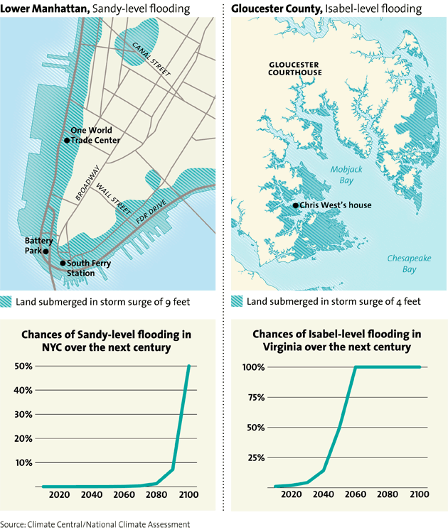
Sandy, as we know, was the result of a combination of horror movie-like conditions: a slow moving hurricane colliding with a Nor’easter over the most populous region of the country, at high tide, under a full moon. It was a situation that, given current sea levels, Climate Central predicted had a less than a one in 10,000 chance of happening in the year 2012. But as you can see above, when we look ahead another 80 years, the chance in a given year of a another Sandy-like storm—one that brings nine-foot storm surges to New York City—approaches 50 percent.
The news is worse yet for places like coastal Virginia which saw $1.9 billion worth of damage after Isabel hit in 2003. In another 25 years, there will be a 25 percent chance that an Isabel-sized storm surge will occur in a given year. After that, the probability rises exponentially every year until that kind of flooding becomes the norm by 2060.
And, of course, it goes without saying that superstorms come with hefty price tags:
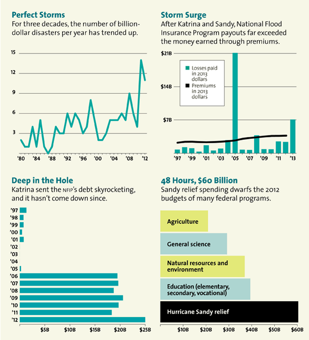
NOAA, FEMA, Congressional Research Service, White House Federal Budget
The takeaway: Whether you live in Gloucester, Virginia, or Columbus, Ohio, as a taxpayer, you’re shelling out for high priced, climate-change-fueled floods—and unless we reform our current flood insurance policy, we may just end up drowning in debt.
