NASA/NOAA GOES Project
This story was originally published by Grist and appears here as part of the Climate Desk collaboration.
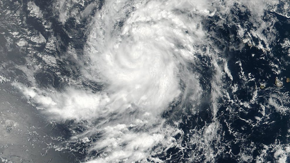
Just days after Hurricane Harvey brought historic rainfall to parts of Texas and Louisiana, another potentially catastrophic hurricane looms in the Atlantic.
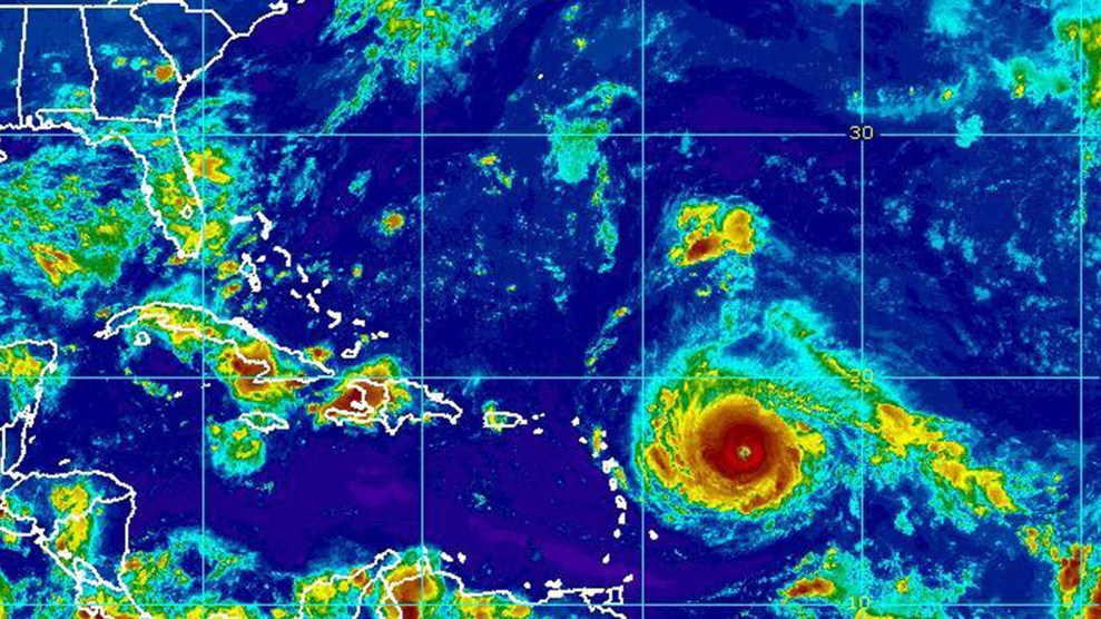
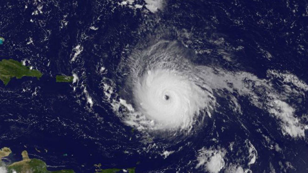
Hurricane Irma rapidly strengthened over warmer than normal ocean waters on Tuesday into a Category 5 storm with estimated wind speeds of 185 mph — the strongest ever measured in the Atlantic Ocean.
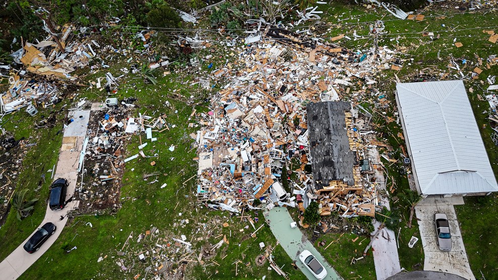
On its projected path through the northern Caribbean, Irma could inflict an almost unimaginable blow. From the National Hurricane Center’s description of Category 5 damage: “A high percentage of framed homes will be destroyed, with total roof failure and wall collapse. Fallen trees and power poles will isolate residential areas. Power outages will last for weeks to possibly months. Most of the area will be uninhabitable for weeks or months.”
Irma has grown in size amid nearly ideal circumstances for intensification over the past several days. On social media, hurricane experts pondered whether or not it should be considered a Category 6 — which it would qualify for if the traditional five-tiered Saffir-Simpson scale were extrapolated for wind speeds as strong as Irma’s.
Once again, many of us in weather feel at bit of a loss. Irma is about to be devastating; no matter the track more of it seems inevitable. pic.twitter.com/zaWQA5IzPT
— John Boyer (@boyerweather) September 5, 2017
People in Irma’s path have never experienced a storm this strong, and a direct hit could rewrite history for entire islands. The storm packs a punch that’s stronger than Andrew or Katrina, two of the most notorious recent hurricanes. In Antigua, one of the islands in Irma’s direct path, the national meteorological service lapsed into prayer.
As meteorologists marveled at the storm from afar, hurricane hunter aircraft sent back jaw-dropping photos from inside the eye. Earthquake scientists in the Caribbean noticed the hurricane’s winds and waves registering on seismographsas it neared the Leeward Islands, an incredible example of Irma’s strength.
Long-range forecast models have repeatedly projected Irma making landfall in South Florida this weekend, though the hurricane could still veer off on a range of possible paths as it approaches the U.S. mainland.
Preparations are already underway in Florida, a historical hurricane hotspot. Somehow, the state has avoided a Category 3 or higher landfall for more than a decade. The last storm to hit Florida at Irma’s current intensity was the “Labor Day” hurricane of 1935—the strongest hurricane to ever strike the U.S. coast.
The state has transformed since the most recent Category 5 hurricane, Andrew, hit in 1992. Miami alone has added 600,000 new residents in that time, and the state’s storm-buffering wetlands have degraded amid a push for urbanization. In the past 25 years, 1 in 10 new homes in America were built in Florida, during a slow spell for hurricane landfalls. That lucky streak now appears to be coming to an end.
A reminder of what's gone on during the South Florida hurricane 'drought.' A lot of moving, a lot of building. via @BMcNoldy #Irma pic.twitter.com/sXwLpNBKMN
— Eric Fisher (@ericfisher) September 5, 2017
What’s more, Irma’s projected path up the spine of the peninsular state poses a unique challenge: If hurricane-force winds are wide enough to affect both coastlines simultaneously—which they’re expected to be—where will people evacuate to? It’s nearly inconceivable to think of millions of people traveling northward out of Irma’s path.
So far, the state is preparing in an orderly fashion. The Florida Keys expect to begin a total evacuation on Wednesday. Miami has shifted to an “all hands on deck” preparedness level, and is considering evacuating its most vulnerable residents. Florida Governor Rick Scott announced he will activate the entire Florida National Guard later this week. President Trump approved emergency declarations for Florida, Puerto Rico, and the U.S. Virgin Islands, which will help speed preparations and aid.
But before Irma reaches Florida, it’ll pass over—or dangerously close to—much of the northern Caribbean: Barbuda, Anguilla, the U.S. and British Virgin Islands, Puerto Rico, and the Bahamas. The northern coasts of the Dominican Republic, Haiti, and Cuba could also feel significant impacts as Irma passes by.
Wherever it strikes, the hurricane’s impact will be worsened by the rising seas and heavier downpours associated with climate change. There’s still a chance the storm could curve safely out to sea after its trip through the Caribbean, but those odds are quickly slipping.
Should the hurricane make landfall in the Virgin Islands, Puerto Rico, or Florida, it will set a regrettable record—the first-ever back-to-back U.S. landfalls of Category 4 or higher storms.
Hurricane Harvey’s catastrophic impact in Texas and Louisiana now ranks as the worst natural disaster in U.S. history. (Hurricane Katrina cost an estimated $150 billion in 2017 dollars, and the Texas governor’s office estimates Harvey could cost $180 billion.) A recent study examined the possibility of a Category 5 hurricane strike in downtown Miami. It calculated that damages from that nightmare scenario could cost upward of $300 billion.
As improbable as it may seem, two of the worst hurricanes in U.S. history might hit in the span of just two weeks.
